
We realized today that the way we’ve been writing our posts, the state of our overall progress on this trip may not be obvious. Therefore, we’re now putting what mile we are at on the ICW in the title of each days post. “Mile 0” of the Atlantic ICW heading south is officially referenced to Norfolk, Virginia. Our destination is St. Augustine, Florida which is at mile 778. We traveled about 170 miles down the Chesapeake before we arrived at Mile 0 in Norfolk, so our total mileage for this trip will end up being around 950 miles.
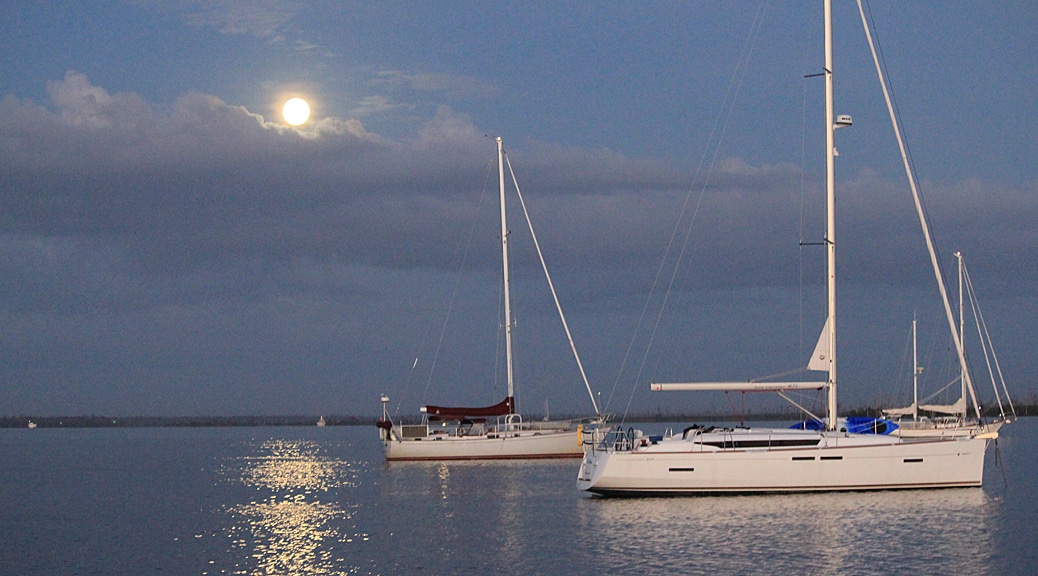
Again, the 7 boats in our anchorage all decided to get an early start. Just after sunrise, but before the full moon set, we were underway.
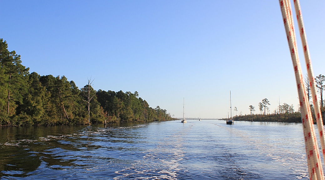
We formed a regular little convoy heading down the Alligator-Pungo Rivers canal, quite narrow and swampy, with the dark tea-colored to black water we have come to know since arriving in NC.
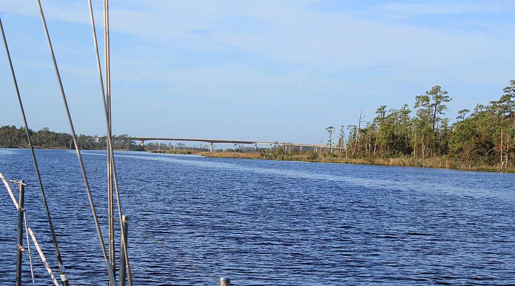
The leader, a catamaran, called back to us on the VHF (as we were second in line) . He had just passed under the Fairfield bridge-a fixed bridge with 65 foot clearance- and stated that the water seemed high to him, and he felt his 57 foot mast cleared with less space than expected. This caused a ripple of anxiety throughout the line of sailboats, and much VHF chatter as to comparative mast and antennae heights. We were next. Tommy took us through slowly and we cleared with some to spare. These glad tidings were hailed with some relief by the boaters behind us. The Wilkerson Bridge, the last we had to pass under for some time, is the lowest charted fixed bridge north of Florida (charted at 64′), so the whole whisper down the lane repeated itself. The first boat through guessed it was actually about 61.5′ because of the high water left over from Matthew. Our boat needs 61′ of clearance (yikes!). Paula, up on the bow, was sure C Ghost’s mast wouldn’t clear, and even yelled back to Tom, “it’s too close! We’re not gonna make it!” But the brave Captain was confident and continued on and we got through with a foot to spare (we both then had to go pee).
Just after the bridge, one of the sailboats in our cavalcade blew a seal and spilled his oil. He limped off the channel under sail via a small jib, and anchored. We did hear him make contact with Tow Boat US, and we were glad help was on the way, but we felt sobered and saddened.
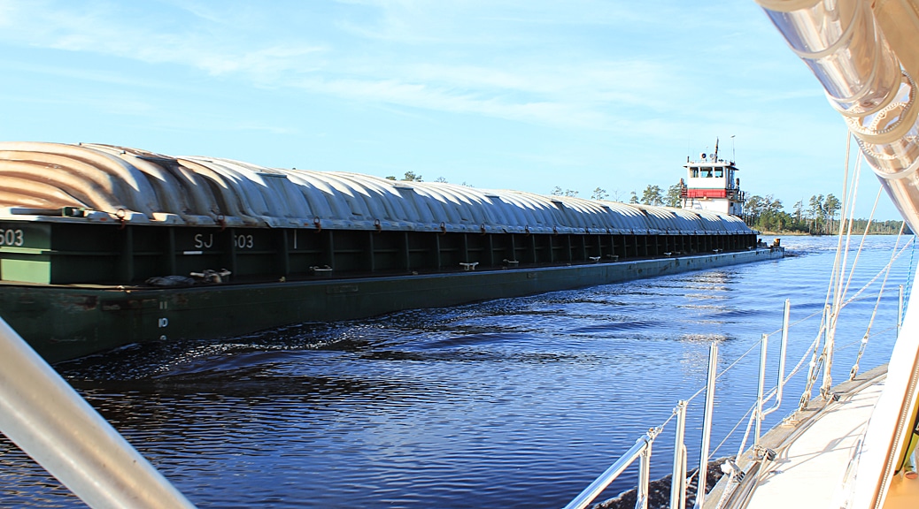
This 21 mile trip through the Alligator-Pungo canal was very beautiful, but at times also very narrow. To those of you following our live track on the map on the home page it may have looked like we went across land for a long time. There was little room for boats our size to pass each other to begin with, and very little room when a big barge came by from the opposite direction.
After the canal, we came into the Pungo river, which today was a flat, calm, expanse of water with no wind, but lots of waterside homes. On this stretch of water the navigation aids reverse, since we entered the river on a heading out to sea. When we reached the channel into Belhaven, they reversed back again since now we were on a heading returning from sea (confusing, but well explained in the cruising guide). We hailed the marina as soon as we got to the Belhaven breakwater, and the proprietress, Brenda Porter, guided us verbally to our spot on their along side dock. She then stuck the radio in her belt, and took our lines herself, along with her husband, Les Porter.
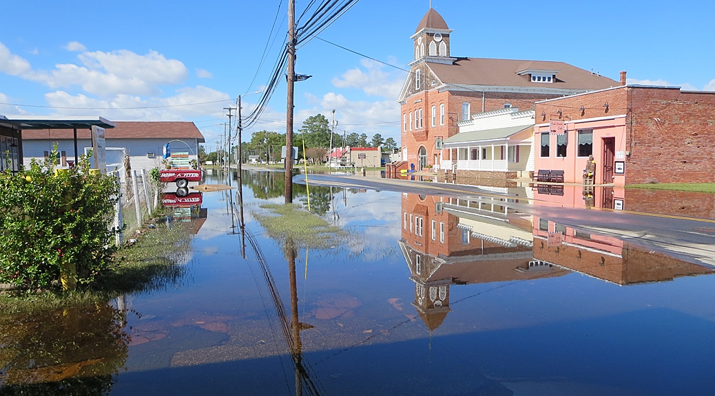
After we tied up we had a nice walk into town and were surprised to see some of the streets still flooded from the hurricane. We were able to do a load of laundry here as well as fill up our water tank. After four nights in a row at anchor, it was nice to walk on land again.
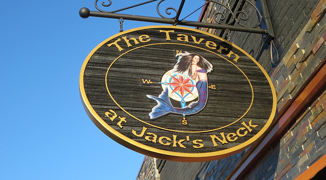
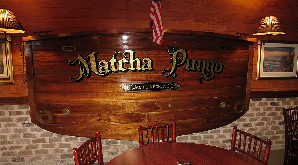
This evening we walked to the only restaurant in town open on Sunday for dinner. It was called “The Tavern at Jack’s Neck” (formerly known as “The Old Helmsman”). The owners and staff were about the friendliest and interesting we’ve ever encountered. Both owners came and spoke to us at length about our trip, the history of the restaurant and what brought them to Belhaven. We were treated to a tour of the in-progress refurbishment of a couple adjacent buildings that they are adding on to the restaurant, all construction work being done solely by them. Oh yeah, the food was awesome, especially the Shrimp and Grits.
5 Responses
Rocket Launch tonight from Wallis Island, VA. I have attached the news article. It should be spectacular for you depending where you are harbored. http://www.philly.com/philly/blogs/real-time/Rocket-launch-to-be-viewable-in-our-area-Sunday-night-.html
Thanks for the heads up, Jean! We are enjoying your comments. We are also looking to the sky for the Orionid meteor shower which should peak later this week. Hoping for a clear view without clouds so we can best enjoy the view.
Woof
Crossing under bridge reminds me of a video of people hanging a big weight off the main halyard to heal boat over to clear under the bridge.
Great details getting to belhaven. Pucker factor way up there for clearance getting under the bridges. Whew is all I can say Glad you made it. So with the tiny armada did they all stop there in belhaven? Will you keep track of the party who’s boat blew the seal. Can’t imagine how disruptive that would be. Stay safe. Look forward to future posts
Interestingly, we were the only boat out of the group we came through the canal with that stopped here. Probably because it was still early in the day (around 1PM) and the others wanted to get further along. In our case, we wanted to visit Belhaven and, despite our long delay in Norfolk, aren’t in so much of a rush.